Maps & Site Locations
-
 by
ksigler
moderator
by
ksigler
moderator
You've probably noticed that, after classifying a clip (and only then), a map is shown indicating the region of Africa that the clip belongs to. If you've ever wanted to see those maps again, or want to know which sites are in which region (helpful for species identification), you've come to the right place! You'll also find the starting and ending clip IDs for each site's dataset, for anyone doing more fine-grained searching or analysis.
As explained here, these regions correspond with the distributions of the 4 subspecies of the chimpanzee, and each of the sites (with the randomized names) will correspond with the research sites seen here: Pan African Programme - Where We Work.
Here are the sites we have so far:
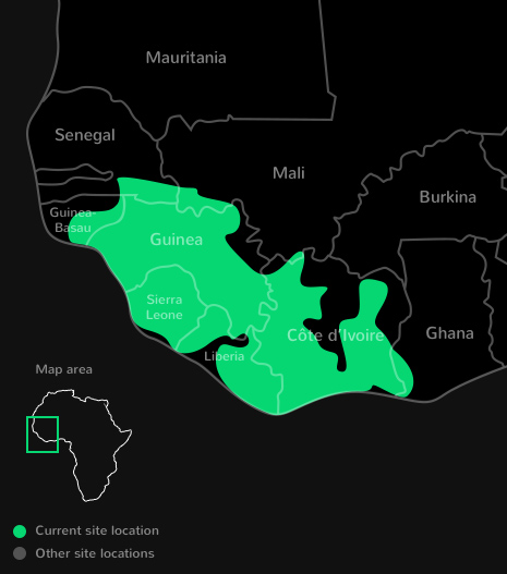
Region A
Includes:
- Cold Snowflake 4 ACP00020ff through ACP00020y6
- Cool Silence 5 ACP00020y7 through ACP0002q84
- Red Water 6 ACP0002q85 through ACP0003jt9
- Muddy Frost 7 ACP0003jta through ACP0004uey
- Crimson Dew 8 ACP0004uez through ACP0005gj3
- Lingering Shape 9 ACP0005gj4 through ACP00060oh and ACP0007eig through ACP0007g6e
- Dry Lake 11 ACP00060oi through ACP0007eif
- Dawn Bird 12 ACP0007g7f to ACP00087li
- Aged Violet 15 ACP000e0g8 to ACP000gq0e
(click map to enlarge +)
Region C
Includes:
- Shy Waterfall 2 ACP0000exo through ACP0000m6n
(click map to enlarge +)
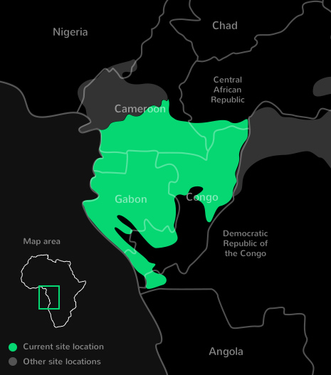
Region D
Includes:
- Quiet Wood 1 ACP0000001 through ACP0000exn
- Cold Fire 14 is ACP000asij to ACP000bd8u
- Restless Star 13 is ACP000bd8v to ACP000cq7e
(click map to enlarge +)
Region B
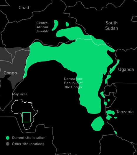
Not used, though possibly in the future.
(click map to enlarge +)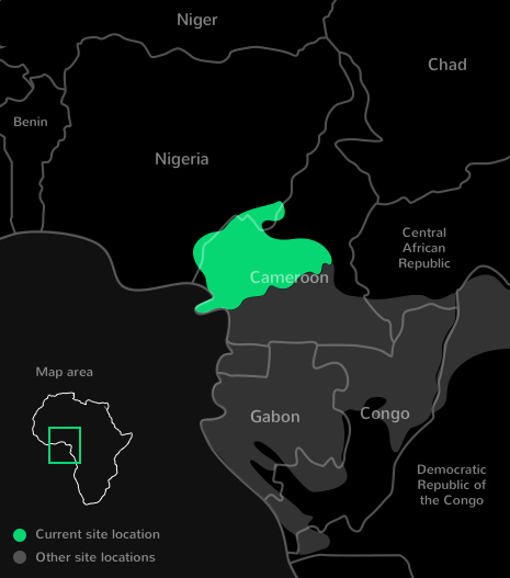
Posted